Feeds:
Posts
Comments

Back on Native Soil

Debbie & Dennis on the Erie Canal.

Debbie & Dennis on the Erie Canal.

August 6, 2009: Ridgeway, ON to Holley, NY

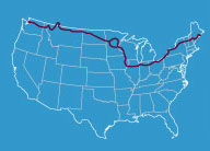
After a fun-filled day on the Canadian side of Niagara Falls, we were ready to return to the good old USA. Today’s route would take us across the Lewiston-Elizabethton Bridge to New York State. Once in New York State, the route wound through rural New York up to Holley, a small town on the Erie Canal. Altogether, the route was about 70 miles long.

The trip across the bridge was somewhat of an experience, since it did not have a designated bicycle lane. Instead, bicycles and automobiles shared the same lanes, which made for an interesting mix.  Once we reached them, the customs people at the border could not have been nicer, as they welcomed us back to the U.S.

Having crossed the bridge, we cycled through Lewiston, NY and made our way onto Upper Mountain Road and into rural New York state. This area was a welcome relief after dealing with the dense traffic around Niagara Falls. Most of today’s route followed the Erie Canal trail, a densely packed sand and gravel pathway that was actually nice to ride on.

A fellow traveler on the Erie Canal.

A fellow traveler on the Erie Canal.

We arrived in Holley, NY and are currently camped at the Firemen’s Park. The park has a nice pavilion, complete with a kitchen that we are allowed to use. Our thanks to Fran for all of his help in making us feel welcome and setting us up in this nice location!

Tomorrow’s ride should start to get us back into climbing shape, as we head for the Adirondack Mountains. The 90+ mile route will take us to Sodus Point, NY.

August 5, 2009: Rest Day at Niagara Falls

Niagara Falls - U.S. side.

Niagara Falls - U.S. side.

Niagara Falls - U.S. and Canadian sides.

Niagara Falls - U.S. and Canadian sides.

Canadian side of the falls aboard the Maid of the Mist.

Canadian side of the falls aboard the Maid of the Mist.

Marshall aboard the Maid of the Mist.

Marshall aboard the Maid of the Mist.

Suzi on the Maid of the Mist

Suzi on the Maid of the Mist

View from beneath the Falls.

View from beneath the Falls.

Mark on the Friendship Trail.

Mark on the Friendship Trail.

August 4, 2009: Port Ryerse, ON to Ridgeway, ON

We are still in Canada, and probably all agree that one of the main reasons that we would like to see Canada in our respective rear view mirrors  is the lack of adequate camping sites. The upside of our northern neighbor, however, is definitely the people; they are generous, out-going and a lot of fun.

The route today took us from Port Ryerse to Ridgeway, a distance of some 75-80 miles, depending upon the route that one chose to take.

No cell phone service at Port Ryerse.

No cell phone service at Port Ryerse.

Chuck, Dennis and Debbie took the longer route along the coast of Lake Erie. Chuck mentioned that the area had a distinct smell all along the route related to algae and bacteria problems in the lake.

Sue and Mark stayed on County Road 3, which was more inland and direct.

Both groups ended up on the Friendship Trail in Port Colborne, adjacent to the St. Lawrence Seaway. The trail, which is an established walking/biking path, extends from Port Colborne to Niagara and the Canadian/US border.

The St. Lawrence Seaway.

The St. Lawrence Seaway.

We are currently camped at Knights Hideaway RV park in Ridgeway, Ontario. Tomorrow we will bicycle the short distance to a KOA camp in Niagara and spend the majority of the day experiencing Niagara Falls.

Our hosts at Knight's Landing - Thank You!

Our hosts at Knight's Landing - Thank You!

Today’s Bicycling Distance: 75 or 83 miles, depending upon the route.

First full day in Canada

Lake Erie as seen from Port Rowan.

Lake Erie as seen from Port Rowan.

August 3, 2009: Eagle, ON to Port Ryerse, ON

After a night in the “party camp” near Eagle, Ontario – Canadians really know how to party and because they are on a three-day holiday, Sunday night was no exception – we headed towards Port Ryerse, a distance of 80+ miles.

The day was beautiful, the wind was favorable, but, again, the shoulders were essentially non-existent. The region of Ontario through which we were bicycling was once a major tobacco-producing area, but is now converting to an assortment of row crops, such as cucumbers and beans.

Tobacco Drying Shed - Port Stanley

Tobacco Drying Shed - Port Stanley.

While Sue and Mark were passing through Port Royal, they met Dennis Shram, a local bicyclist. After a visit, Dennis invited the Petersens to his house just east of Port Royal, where they met Dennis’ wife Wanda, and had a nice visit. Prior to leaving the Shrams and heading for Port Ryerse, Dennis presented the Petersens with lighted safety vests for all of the riders in our group. The vests are great!! Thank you Dennis and Wanda for your kind hospitality and for the terrific vests.

Tomorrow’s ride will take us closer to the US border and Niagara Falls, as we make our way to an area east of Fort Coburn, Ontario.

Distance Bicycled Today: 85 miles

Campsite at Norfolk Conservation Park

Campsite at Norfolk Conservation Park.

Going International

Canada Bound!

Canada Bound!

August 2, 2009: Marine City, MI to Eagle, Ontario, Canada

After experiencing yet another early morning rain shower, we packed up and headed for the ferry that transported us across the St. Claire River to Wallaceburg, Ontario. As we passed through Wallaceburg, one of the local police officers actually turned on his flashing lights and escorted us through town!

Police escort through Wallaceburg.

Police escort through Wallaceburg.

The Canadian roads and highways were well-paved, with the exception of the shoulders; there were virtually no shoulders until we reached Elgin County, Ontario (About 30 miles into the ride).

Since this is a long weekend in Canada (its a civic holiday with no official name – Canadians tend to just call it “August Long Weekend”), camping sites were limited. We finally found a place about 2 miles east of Eagle, Ontario, near the banks of Lake Erie.

A real highlight for today came when Chuck, Sue and Mark broke off of the route in Dresden and visited the home of Josiah Henson, one of the first beneficiaries of the Underground Railroad. Henson’s memoirs served as the inspiration for Harriette Beecher Stowe’s Uncle Tom’s Cabin.

Sue at the home of Josiah Henson.

Sue at the home of Josiah Henson.

Distance Bicycled Today: 70 miles


Marshall riding the ferry to Canada.

Marshall riding the ferry to Canada.

Camp near Eagle, Ontario.

Camp near Eagle, Ontario.

Another Symbol of Amish Country.

Another Symbol of Amish Country.

August 1, 2009: North Branch, MI to Marine City, MI

The plan for today was to leave early from our campsite near North Branch, Michigan and head  for Algonac State Park just south of Marine City, MI. An early arrival at the park would allow us to plan our entry into Canada tomorrow.

We departed under sunny skies and headed towards Marine City. The route was a little less difficult to follow than was the case yesterday, with the exception of a bike path that ostensibly connected Marine City with Algonac – the Adventure Cycling maps failed to indicate that the bike path had not yet been completed.

Regardless, we all found our way to the park where rain looks like a strong possibility. Today’s riding was likewise made a little more difficult by a constant headwind that existed throughout most of the day.

Camp at Algonac State Park.

Camp at Algonac State Park.

A word about the shoulders  along the roads of the Michigan highways and roads:  they are immaculate, trash and debris are virtually absent. The state of Michigan appears to have a very effective adopt-a-highway program.

Tomorrow we will ferry across the St. Clair River and enter Canada.

Today’s Bicycling Distance: 75 miles.

An ore boat on the St. Claire River.

An ore boat on the St. Clair River.

Chuck: Today is our last day in Michigan. We are parked in the Algonac State Park Campground on the St. Luis River.  Ontario is just across the river which is where we go tomorrow and for the next three days as we skirt the northern edge of Lake Erie.  We then emerge from Canada in three days at Ft. Erie and Niagara Falls.

Thanks to all in Pendleton who fulfilled our request for no more rain and some warmer weather.  The past week has been warm, dry in the day and mostly blue sky.  We are out of the vast fields of corn, potatoes, spelt, alfalfa, and other produce which has been our constant companion for this week.  The roads have been mostly flat and lined with beautiful wildflowers. Riding has been a joy.

Transportation contrast, North Branch, Michigan.

Transportation contrast, North Branch, Michigan.

Today was 80 miles mostly into strong headwinds. As we approached the end of the ride, we were directed to a poorly marked trail system that caused most of us to get lost at least a few times.  Dennis, Debbie and I crashed a wedding taking place on the unmarked trail.  I was asked if I was with the bride or the groom.

That’s all for now. Keep sending the nice weather – hopefully it is cooling off back in P- town!!

Michigan wolverine

Michigan wolverine

[Ed. Note: Blog Central is reunited with a strong Internet connection.  We’ll try to have everything caught up by tomorrow.]

July 31, 2009: Bay City, MI to North Branch, MI

The first eight miles of today’s ride took about one hour as we jigged and jagged around the streets of Bay City, MI. Adventure Cycling map routes attempt to take riders off of congested roads, where traffic is heavy. The down side of this practice is the challenge of finding your way through a maze of city streets with which you are not familiar.

Fortunately the local residents of the Northern Tier are very friendly and helpful. We have had experiences where people have told us to follow behind their cars or trucks as they lead us to a certain street or road. Other residents have actually followed along behind us to make sure that we followed their directions correctly.

Once we finally exited Bay City, we headed for North Branch, Michigan, a distance of 75 miles. The ride was going along great with nice roads and wonderful weather until we reached Caro, MI and found that a bridge had washed out over one of the major roads (Chambers Road). We sought out directions and found an alternative route that took us about 4 or 5 miles off of the route, but got us to our destination nonetheless. We are currently camped at a very nice private campground just outside of North Branch.

Tomorrow we will ride to Marine City, a town on Lake Erie that will serve as our jump-off point into Canada. Tomorrow’s ride should be about 70 miles.

Miles Bicycled Today: 75 miles


Comes complete with a hitching post in the front yard

Comes complete with a hitching post in the front yard

Lotsa corn in Michigan.

Lotsa corn in Michigan.

Lunch in Fairhome.

Lunch in Fairhome.

One of many patrotic barns along the way.

One of many patrotic barns along the way.

Light posting this week

Mrs. Blog Central and I will be on vacation in decidedly rural Oregon this week, so posting and comment moderation will be spotty at best.  We’ll try to update the POW crew’s adventures as much as possible, but doing so will rely upon the availability of web access in places like Halfway and Frenchglen…

As partial compensation for the lack of daily updates, we humbly submit the following.

Thanks for your continued readership.  As of this writing, the POWC2C blog has logged 17,819 page views and 374 comments!  Not too shabby, I’d say.

Debbie and Dennis on the Pere Marquette Trail

Debbie and Dennis on the Pere Marquette Trail

July 30, 2009: Clare, MI to Bay City, MI

We left our campsite at the city park in Clare, Michigan this morning and headed for Bay City, MI. At the edge of Clare, we caught the Pere-Marquette Rails-to-Trails route, a converted railroad track that has been repurposed to a bike, walk, run and skate path. The trail extended from Clare to Midland, a distance of about 28 miles. It was comforting to be on a road where you felt safe from automobile traffic.

Once we reached Midland, the traffic situation changed considerably – the route through town was confusing for the majority of us  and the shoulders were almost non-existent in places. Thankfully, we arrived at Bay City safely and are currently camped at the Bay City State Park.

A word about the Michigan state parks – they’re fabulous! They certainly rival the majority of the Oregon state parks. The spaces are clean and spacious; the bathrooms and shower facilities are superb.

A note of thanks as well to Chuck, our camp host at Peterson Bridge Campground. We were not able to obtain a internet connection within the park and Chuck was kind enough to lend us use of his dial-up link so that we could transmit the text portion of the day’s blog. Thank you so very much, Chuck!!

Tomorrow’s ride will take us from Bay City to North Branch, MI, a riding distance of about 65 miles.

Today’s total: 55 miles

Marshall:    Ann and I were fortunate enough to be able to visit the Amish community near Clare, Michigan. We visited three different farms. Ann visited with an Amish woman who makes quilts; the family also made and sold jams, jellies, baskets, farm fresh bread and maple syrup. Ann purchased two baskets:

Ann with her Amish baskets.

Ann with her Amish baskets.

I also visited two farms. At one of the farms, I witnessed a stationary threshing machine in action.  Horse-drawn wagons loaded with shocks of grain lined up to run the grain through the machine. The threshing machine was comprised of wood, circa 1800 -1900 construction. The machine was powered by an old Detroit diesel engine powered by horses – no fuel-powered machines of any type are used in the Amish farming operations. I was not able to take photos of any of the Amish farmers due to their religious beliefs.

Old-time threshing machine.

Old-time threshing machine.

The second farm that I visited had fresh fruit and vegetables for sale. While at the farm, a young girl came out with a fresh loaf of bread and some fresh-picked raspberries. Of course, I could not resist the temptation to purchase the bread and raspberries both.

Grain shocks in an Amish field.

Grain shocks in an Amish field.

The Erie Connection

Sunset over Lake Michigan.

Sunset over Lake Michigan.

July 29, 2009: Garletts Corners, MI to Clare, MI

We left our camp at Peterson Campground on the banks of the Pine River in cool but clear conditions. As the day progressed, the temperature rose and the day was very comfortable. Our goal was to bicycle to Clare, MI, a distance of about 85 miles.

Peterson Park.

Peterson Park.

Once we completed the first 20 miles of today’s route, we passed through the town of Luther; this point marked the beginning of the Erie connection, a route that will take us through Canada to New York state.

Today’s ride meandered through a portion of Michigan’s Amish country, complete with these kind, hard-working  people and their signature horses and buggies. The wind was favorable for the majority of the day and the shoulders were very good for the most part.

Amish barn.

Amish barn.

Marshall found a nice camp site at the city park in Clare. After using our portable shower for the second day in a row (the shower still works great, Howard), we enjoyed one of Marshall’s signature pork steak dinners.

Tomorrow’s route will be a short 51-miler from Clare to Bay City, MI.

Today’s bicycling distance: 84 miles


Cherry pickin' on the Michigan Peninsula

Cherry pickin' on the Michigan Peninsula

Our camp in Traverse City.

Our camp in Traverse City.

Our friends at Grand American Pie Co.

Our friends at Grand American Pie Co.

Sue and Mark draggin' with Suzi

Sue and Mark draggin' with Suzi